


Google Earth Now Creates AI Images of Real Places
Imagine Google Earth transforming into a powerful visual creation tool. With the integration of the Nano Banana 2 model, this is now a reality. Users can generate customized images from real maps and three-dimensional structures. And it’s not just for geeks or specialists. It’s available globally, allowing for the creation of everything from urban simulations to historical reconstructions and infographics.
Google announced this news, highlighting the integration of Nano Banana 2 into Google Earth. The platform gains a new dimension beyond traditional 3D visualization. And the detail is that this functionality is already available, but with usage limits that vary according to the chosen plan. The Advanced Pro plan, which offers unlimited access, currently costs US$ 150 (about R$ 760).
The Model that Transforms Maps into Art
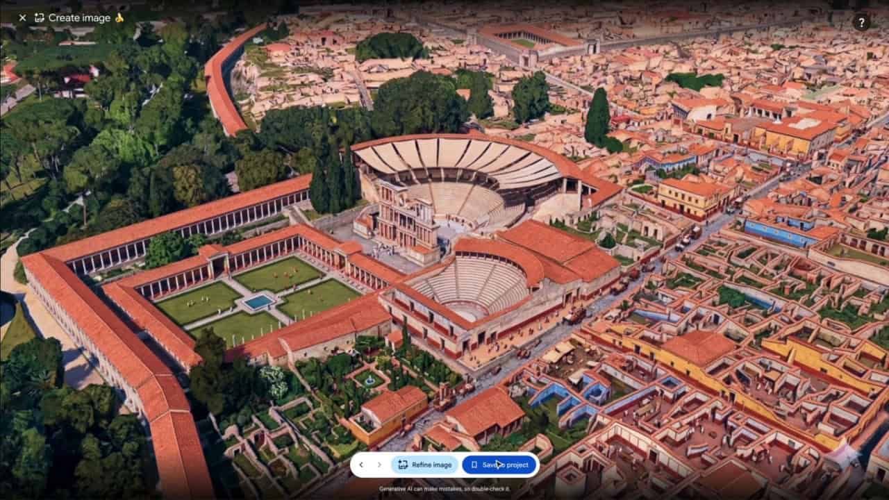
Google Earth, often seen as a turbocharged Google Maps, is now reinventing itself. The proposal is to use the map as a basis for visual creations. This includes urban simulations, infographics about tourist spots, and even historical reconstructions. The generated image preserves elements such as terrain scale, map perspective, and the location of streets, buildings, and monuments.
And it doesn’t stop there. The feature also integrates with Gemini, another Google AI. When you request an infographic about a specific location, Gemini searches for relevant historical information. Then, Nano Banana 2 transforms that data into a visual composition. Imagine creating an infographic about the Statue of Liberty, where Gemini gathers the facts and Nano Banana 2 creates the image.
How to Explore This New Tool?
Using this new feature in Google Earth is simple. Just open the platform in your browser, navigate to the desired location, and adjust the zoom. Then, click on "Create Image" in the toolbar and describe what you want to see. The AI generates the image at different scales, from a specific lot to neighborhoods, cities, or historical regions.
This integration of Nano Banana 2 is a leap for Google Earth, which becomes an even more robust and versatile tool. The feature promises to be a differentiator, especially for those working in urban planning, education, or tourism.
With this update, Google Earth ceases to be just a navigation tool. It becomes a creative platform capable of transforming geographic data into visual art. And, who knows, this may just be the tip of the iceberg in terms of innovation with AI.
Comments (0)
Comments are moderated and if they violate our Terms and Conditions of use, the comment will be deleted. Persistence in violation will result in a ban of your account.